
Walk a Westchester County Street
For a Westchester County street directory search, begin with the exact address, then follow the record trail in order: address, owner field, recorded deed, and historic directory. The Westchester Municipal Tax Parcel Viewer is municipality-selected, so first identify the city or town with jurisdiction over the address. Its property row may supply the parcel address, print key, SBL, and an owner name where the municipality supplies one. Those details are useful leads, not proof that a named owner is currently at the property.
- Confirm the delivery address and select the correct Westchester County municipality in the Parcel Viewer.
- Record the displayed situs address, owner field if present, print key, SBL, and map or subdivision clues.
- Use the owner name and recording period in Westchester Records Online to locate the relevant recorded transfer.
- Preserve the grantor, grantee, recording date, document reference, and legal description before following the earlier transfer.
- For an older address question, compare the resulting time window with a local historic directory, atlas, or census record. A directory entry is a period clue, not continuous occupancy proof.
New York’s individual voter tool requires a name, date of birth, county, and ZIP. It is not a public street roster. Likewise, a polling-place result describes civic geography, not the people at nearby addresses. That boundary keeps the street-by-street process focused on parcel and document records.
Westchester County Address Records Start Locally
Westchester County has 43 municipalities, and local assessors remain the assessment authority. A postal place name does not settle which municipality keeps the approved tax map. The county viewer is useful for locating a parcel, but it warns that owner information is not available or complete for every municipality and that its mapped geometry is not a survey or deed description. Ask the local assessor to correct or verify a municipal tax-map question.
Choose the municipality before trying a street name. The Viewer restricts each query to the selected municipality. A successful postal address can cross a municipal line, while tax and recording records depend on the actual jurisdiction and the parcel identifiers. The county’s ZIP map is approximate Census geography, not a Postal Service boundary. For an uncertain delivery label, verify the address with the USPS ZIP Lookup, then return to the municipality-selected parcel search.
Note: A mailing-city label, ZIP, and municipal parcel location can differ without indicating an error in the record.
Westchester County Street Directory Search Fields
The Parcel Viewer has a small, specific search form. It does not publish a general street-browse list. Select a municipality, accept the notice, and use the address, print-key, or SBL entry field. Address queries need at least two consecutive characters, after which the candidate list helps choose the intended property. The optional owner-name setting is only useful where local ownership data has been supplied.
| Viewer control | Input type | Required | Westchester County use |
|---|---|---|---|
| Municipality | Selection | Yes | Sets the local search area before a parcel search. |
| Enter Address or Print Key or SBL | Text | Yes, for a direct query | Accepts an address, full or partial print key, or SBL. |
| Search by owner’s name | Checkbox | No | Uses the owner field where that municipality provides it. |
| Candidate dropdown | Selection | For address results | Choose the intended address after entering consecutive address characters. |
| Search / Clear | Buttons | No | Runs or resets the selected municipality query. |
Results show Owner, Prop Address, Printkey, and SBL, and a selected row can map the parcel. Tax Maps, Aerial Photos, Hybrid, Print, Export Map, and More Data support orientation and recordkeeping. They do not turn the map into an address list of people.
Westchester County Street Record Terms
Old and current records use several keys for the same ground. Keeping them separate prevents a street directory search from drifting to the wrong parcel, especially when a street number or postal label has changed. The legal description and parcel identifiers are often more durable than a display address.
- Parcel
- A defined property unit in the tax-map system, commonly connected to an SBL or print key.
- Situs address
- The physical property address carried by the tax roll. It identifies the parcel’s location.
- Plat
- A filed subdivision or property map that can connect a lot or block description to a street address.
- Criss-cross directory
- A reverse directory section arranged by address rather than by name, when a local volume includes one.
The Tax Parcel Viewer’s data service also separates the property address from tax-mailing fields. That distinction becomes important before treating any address as a connection to a particular person.
Westchester County Deeds Behind a Street
The parcel’s owner field and legal clues lead to the recorded-document route. WRO presents Land Records, Legal Records, Maps, and Trades modes, while the County Clerk’s recording logic indexes conveyances and mortgages by parties, recording date, and liber/page. Locate the current transfer by a party name and known period, then keep the document number or book/page, municipality, and legal description with the address notes. A recorded sale does not establish a seller’s later address or everyone connected with the parcel.
WRO’s registration page documents the account details used for image and report access.
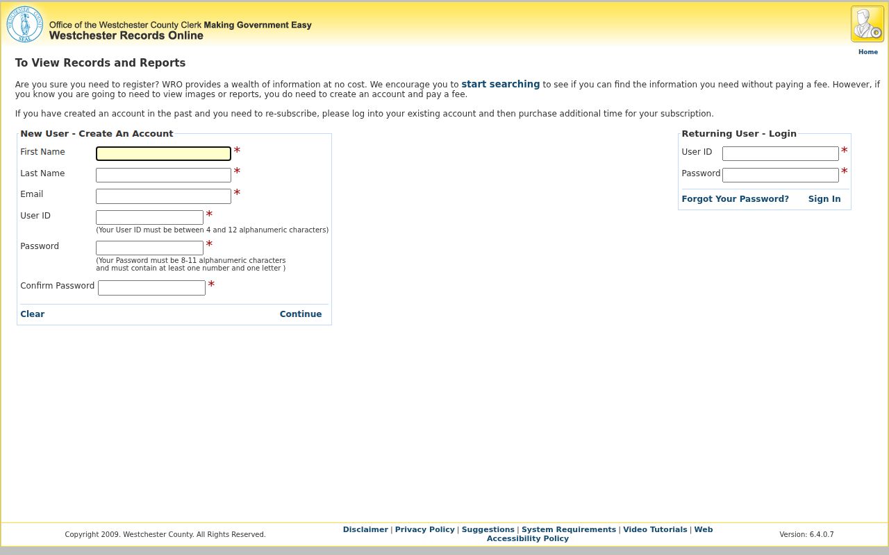
The image confirms the distinction between the public gateway and account-based image or report access. WRO’s remote-access terms list $20 for one day and $1,200 for 365 days per assigned user ID, paid in advance; those figures are access terms, not a per-document price. The authenticated Land, Legal, and Maps field menus were not available for inspection, so no undocumented WRO filters should be assumed.
For a pre-1907 deed-chain question, use the County Archives grantor/grantee index rather than forcing a current portal to supply a complete earlier answer. The Archives also holds mortgagor indexes for 1680–1897.
Westchester County Street Records Compared
Each address-keyed source answers a different question. A parcel result may be the quickest way to identify land and the current tax-roll owner field. A deed names recorded parties and includes legal-description evidence. A local permit file can date a work event, but no single countywide all-years permit search was identified. Use the source’s stated purpose rather than combining its fields into a claim it does not support.
| Address record | Custodian | Useful street detail | Access boundary |
|---|---|---|---|
| Tax parcel and assessment record | Local assessor; county viewer | Parcel, property address, SBL or print key, owner field, values | Owner data can be incomplete; the local tax map governs. |
| GIS map and layers | County GIS | Parcel position, aerials, districts, and surrounding physical context | Planning geometry, not a survey boundary or person roster. |
| Recorded deed, mortgage, or map | County Clerk / WRO | Parties, recorded date, legal description, book/page or document reference | Party index is not an address-only directory; images and reports need an account. |
| Historic deed or mortgage index | County Archives | Grantor/grantee deeds 1680–1907; mortgagor index 1680–1897 | Reading Room or mail research, with Archives fees. |
| Historic atlas or filed map | Archives / County digital collections | Street, lot, subdivision, and some map labels | Check the legend and year, then confirm with documents or directories. |
Mailing Fields in Westchester Street Records
A useful Westchester County quirk is that the parcel service exposes both property and tax-mailing data. Its fields include the situs/property address, print key, SBL, local ZIP, owners, and separate MAIL_ADDR, PO_BOX, MAIL_CITY, MAIL_STATE, and MAIL_ZIP fields. A mailing field can point to a post-office box, agent, estate, business, another property, or other correspondence destination. It is a lead for a record question, not proof of where an owner is present.
The County tax-parcel data service describes those distinct fields and the local-geometry and roll-year caveats behind them.
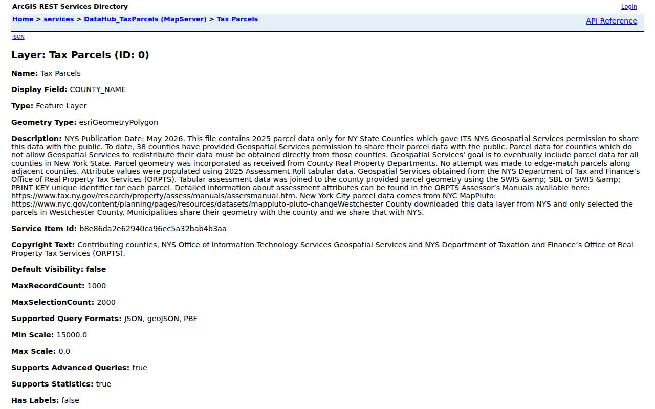
The service is most helpful for understanding why `LOC_ZIP` and `MAIL_ZIP` may not match. A local assessor remains the verification point for the actual tax roll and approved map.
Note: A tax correspondence address should never be converted into a statement about personal presence at a parcel.
Westchester County Historic Street Listings
Historic reverse and criss-cross directories can supply an address-indexed lead where a volume includes a street section. They are not a countywide continuous series. Yonkers Public Library documents reverse-address microfilm for 1895–1900 and 1900–03, then criss-cross or reverse volumes for 1936 and 1939. New Rochelle’s documented local-history collection includes Turner, Richmond, and Polk runs, with its own gaps and dates. A listed address is best read beside an atlas, deed, and census window.
The collection details and shelf routes belong with the Westchester County city directory collections. For a street question, use a reverse section to test an older address after the parcel and deed trail identifies the right municipality, lot, or period.
Westchester County Street Changes Need Context
There is no verified countywide chronology for street renumberings or renamings. One documented Westchester Historical Society example concerns Port Chester: 44 Alto Avenue was renumbered 43 Alto Avenue. That is a warning about a specific address-continuity problem, not evidence that every county street underwent a similar change.
When a number fails, compare the old subdivision name, lot or SBL, spelling variants, nearby streets, and map context. The 1929–31 Hopkins atlas collection has town, street, and subdivision indexes across four volumes. A municipal historian, local tax map, and historic directory street section are sensible additional checks.
Westchester County Street Maps Add Context
The GIS viewer offers Tax Maps, Aerial Photos, and Hybrid views, along with map export and additional layers. Its historic aerial sequence includes 1947, 1960, 1976, 1990, 2000, 2004, 2007, 2009–11, 2013, 2016, 2018, 2021, 2023, and 2025. These layers can help date a visible road or building change. They do not identify occupants.
For much older context, County digital atlases include 1867, 1881, 1901, 1910–11, and 1929–31. Filed property maps go back to 1774, though the digital collection is only a selection. Treat a map label or neighboring owner label as a lead to the cited deed, not a conclusion about an address.
Street Directory Limits in Westchester County
A Westchester County street directory can locate property records and recorded parties, but it cannot reveal everyone connected with an address. The Parcel Viewer does not identify other occupants, utility accounts, DMV addresses, or protected voters. The state voter lookup is for an individual’s registration and election services, not street browsing. County GIS and historic maps provide physical and civic context, not a list of people at a location.
Lawful use. Use Westchester County parcel, deed, map, and directory records for lawful personal research and civic or family-history questions. Do not use them to stalk, harass, intimidate, or harm anyone.
Westchester County Street Directory Requests
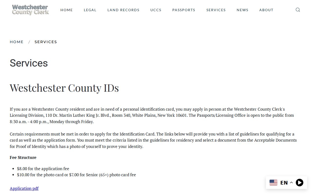
When the online index stops, ask the custodian for the particular record. The Westchester County Clerk services route sends deeds to Land Records and legal-file questions to the Legal Division rather than a generic FOIL request. The Clerk’s office is at 110 Dr. Martin Luther King Jr. Boulevard in White Plains, with the Daronco Courthouse at 111 Dr. Martin Luther King Jr. Boulevard. Its general hours are weekdays 8:30 a.m.–4:30 p.m.
The County Clerk services route identifies the divisions that handle direct land, legal, map, and related records requests.
For historic material, the County Archives reading room and research-by-mail service are the alternate channels. Visitors register with photo ID; public hours are Tuesday and Wednesday, 9–4, subject to advance contact. The Archives lists $15 for an indexed-record retrieval and $25 an hour for custom research, with stated copy and payment rules. Its historic-deed, map, and surname-index holdings often provide the practical next step for an older street record.